EarthScape Surveys
GPR, Utility & Geophysical Survey Company in Saudi Arabia (KSA)
About EarthScape Surveys
EarthScape Technologies for Survey and Geological Exploration provides GPR, underground utility, geophysical and topographic surveys to contractors, consultants and developers. Please visit our services pages for full detail on what we can do for your project.
Our team includes geophysicists, surveyors, utility detection specialists and CAD engineers. We work from early site investigation through design, construction and as-built records.
Our office is in Riyadh, and our field teams mobilise to project sites across the Kingdom of Saudi Arabia, in cities, plants, roads, deserts and coastal areas.
See examples of our work across the Kingdom in our project portfolio.
Underground Surveying Services
Locate and map what lies below roads, plants and building sites before you dig, drill or core.
GPR Survey
Ground penetrating radar to map pipes, cables, voids and buried structures without excavation.
View service detailsUnderground Utility Detection
Locate and mark metallic and non-metallic utilities before excavation, with drawings for design.
View service detailsPAS 128 Utility Survey
Utility surveys delivered to PAS 128 quality levels QL-D to QL-A for design and construction.
View service detailsCable & Pipe Locating
Electromagnetic locating of live power cables, telecom lines and metallic pipes.
View service detailsTrial Pits
Hand-dug trial pits and trenches to expose and confirm buried services and ground conditions.
View service detailsRebar & Concrete Scanning
Scan slabs, walls and columns for rebar, conduits and post-tension cables before coring or drilling.
View service detailsGeophysical Surveying Services
Understand ground conditions, rock depth and hidden hazards across large sites, quickly and non-invasively.
ERT Survey
Electrical resistivity tomography to image soil layers, groundwater, cavities and contamination.
View service detailsMASW Survey
Shear-wave velocity profiles (Vs30) for site classification, foundation and seismic design.
View service detailsSeismic Survey
Seismic refraction and reflection to measure layer depths, rippability and bedrock.
View service detailsMagnetic Survey
Magnetometry to detect buried metal, pipelines, tanks and geological features.
View service detailsGravity & Microgravity
Microgravity surveys to find voids, karst and density changes beneath the surface.
View service detailsCavity & Sinkhole Detection
Combined geophysical methods to detect cavities and sinkhole risk before construction.
View service detailsLand Surveying Services
Accurate survey data and drawings for design, construction control and as-built records.
Topographic Survey
Detailed ground levels, contours and features using GNSS, total station and drones.
View service detailsDrone (UAV) Survey
Aerial mapping for orthophotos, surface models, contours and stockpile volumes.
View service details3D Laser Scanning
Point clouds of buildings, plants and structures for measured drawings and BIM.
View service detailsSetting Out & As-Built
Site control, setting out of piles, gridlines and roads, and as-built checks as work progresses.
View service detailsMobile Mapping
Vehicle-mounted scanning of roads and corridors, capturing kilometres of data in a day.
View service detailsHydrographic Survey
Bathymetry and seabed surveys for coastal, marine and port projects.
View service detailsSurvey Across KSA
EarthScape works all over Saudi Arabia
Compliance
Certifications & Registrations
ISO-certified, approved supplier and fully registered in the Kingdom of Saudi Arabia. Click any certificate to view it.
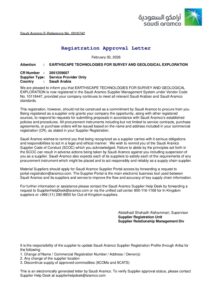 Registered SupplierSaudi AramcoVendor Code 10118447View →
 Commercial RegistrationSaudi CRCR No. 2051259607
Unified No. 7039777359View →
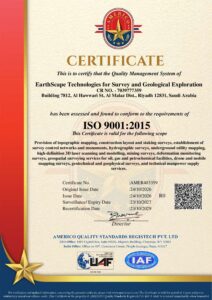 Quality ManagementISO 9001:2015Cert. No. AMER403359View →
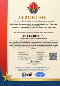 Environmental ManagementISO 14001:2015Cert. No. AMER403360View →
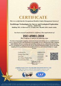 Occupational Health & SafetyISO 45001:2018Cert. No. AMER403361View →
ISO certificates issued by AMERICO (UAF / IAF accredited) · valid until 23 Oct 2029, subject to annual surveillance
Our Clients
Trusted by leading organisations across Saudi Arabia






FAQ
Questions clients ask us
Quick answers about our GPR, utility, geophysical and topographic survey services in Saudi Arabia. Can't find what you need? Talk to our team.
What is a GPR survey?
Ground Penetrating Radar (GPR) sends radio waves into the ground to detect buried utilities, voids, rebar and structures without digging. EarthScape carries out GPR surveys across Saudi Arabia.
Do you work outside Riyadh?
Yes. Our office is in Riyadh, but we carry out GPR, utility, geophysical and topographic surveys anywhere in the Kingdom of Saudi Arabia.
What is a PAS 128 utility survey?
PAS 128 is a specification for underground utility detection, verification and location. It defines quality levels from QL-D (desktop records) to QL-A (physical verification by trial pits).
Which geophysical surveys do you offer?
We offer GPR, MASW, seismic refraction, electrical resistivity tomography (ERT) and magnetic surveys for utilities, geotechnical and site investigation projects.
How do I get a quote?
Call or WhatsApp us on +966 55 679 8661 or email info@earthscapesurvey.com with your site location and scope, and we will send a quotation.