
PAS 128 Underground Utility Survey in Saudi Arabia
Know what is under the ground before you dig with PAS 128 utility surveys across Saudi Arabia.
Home / PAS 128 Underground Utility Survey
Striking a buried cable or pipe can injure workers and stop a project for days. A PAS 128 utility survey tells you what is under the ground before you dig, how it was found and how confident you can be in each line on the drawing. EarthScape Technologies delivers PAS 128 utility surveys across the Kingdom of Saudi Arabia, including Riyadh, Jeddah, Dammam, Makkah and Madinah, from our head office in Al Malaz, Riyadh.
What Is a PAS 128 Utility Survey?
PAS 128 is the specification for underground utility detection, verification and location, first published by the British Standards Institution (BSI) in 2014. Its key idea: every utility on a survey drawing carries a quality level showing how that information was obtained. Detection (QL-B) uses GPR and electromagnetic cable and pipe locating; verification (QL-A) uses trial pits.
The Four PAS 128 Quality Levels
- QL-D: Desktop utility records search. Existing records are collected from utility owners and other sources. They show what may be present but are often incomplete.
- QL-C: Site reconnaissance. A walkover survey identifies visible surface features such as manholes, valve covers, chambers and marker posts, and correlates them with the records.
- QL-B: Detection. Geophysical techniques, mainly ground penetrating radar (GPR) and electromagnetic location (EML), are used to detect and map buried utilities. PAS 128 divides QL-B into sub-levels according to how confidently each utility was detected and located.
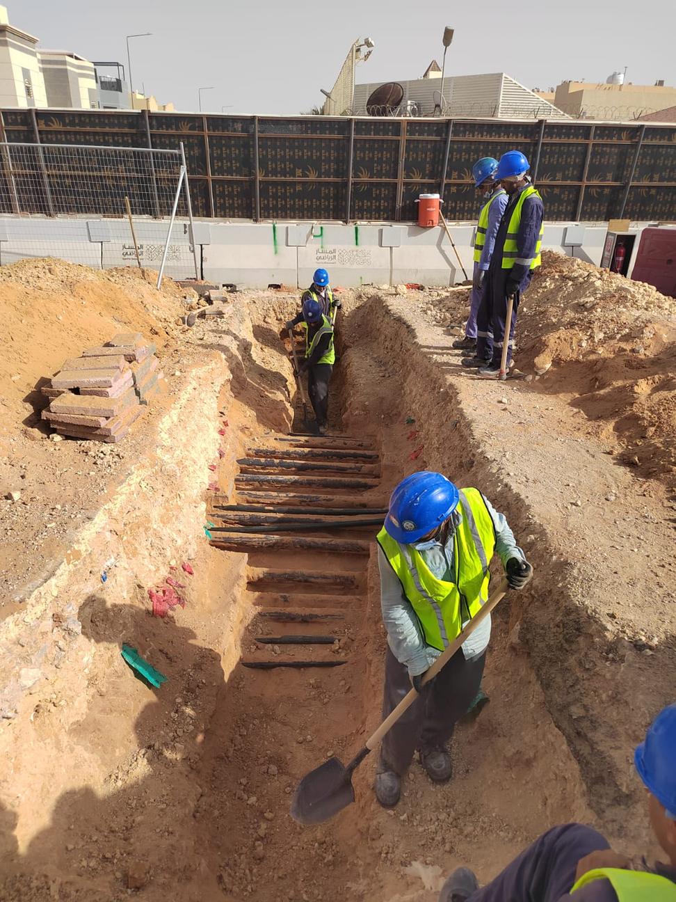
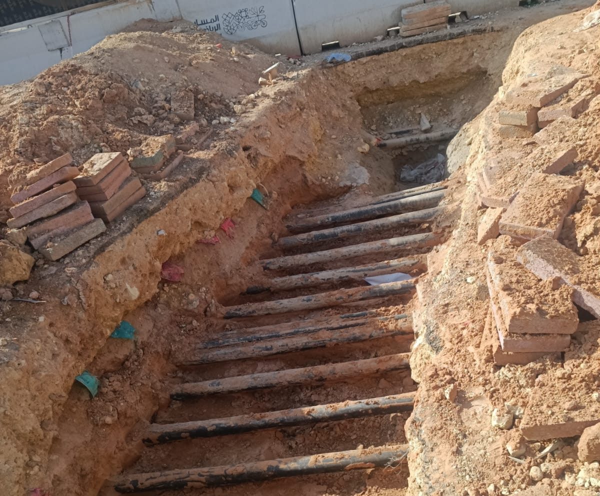
- QL-A: Verification. Utilities are exposed, for example in trial pits or trial holes, so their position, depth, type and size can be confirmed directly.
Most projects need a combination: QL-D and QL-C to plan, QL-B to map the site, and QL-A at critical crossings or where detection is uncertain.
Related guide: PAS 128 quality levels explained.
Our Method and Equipment
A typical workflow is:
- Records and reconnaissance (QL-D/QL-C): we review the available records and inspect every visible surface feature on site.
- Electromagnetic location: precision locators and signal transmitters trace metallic cables and pipes in passive and active modes.
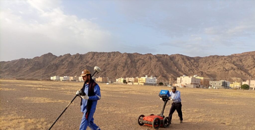
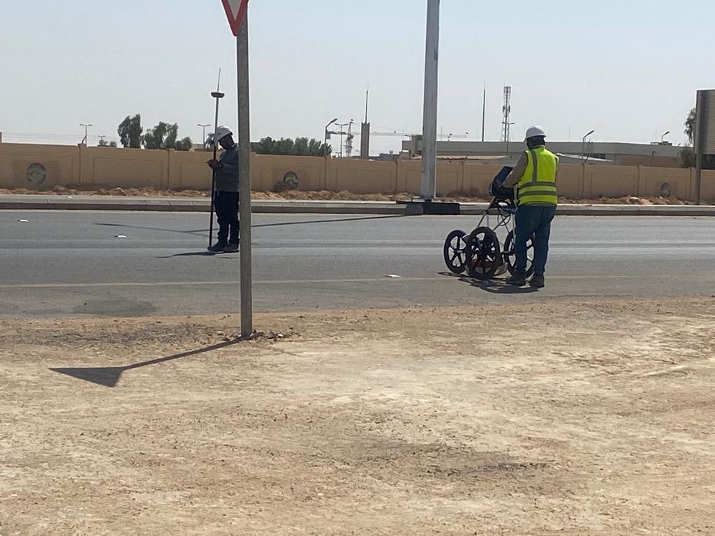
- Ground penetrating radar: we use the latest GSSI 350 HS (350 MHz HyperStacking) GPR system to detect metallic and non-metallic utilities and cover large areas such as roads and airfields efficiently.
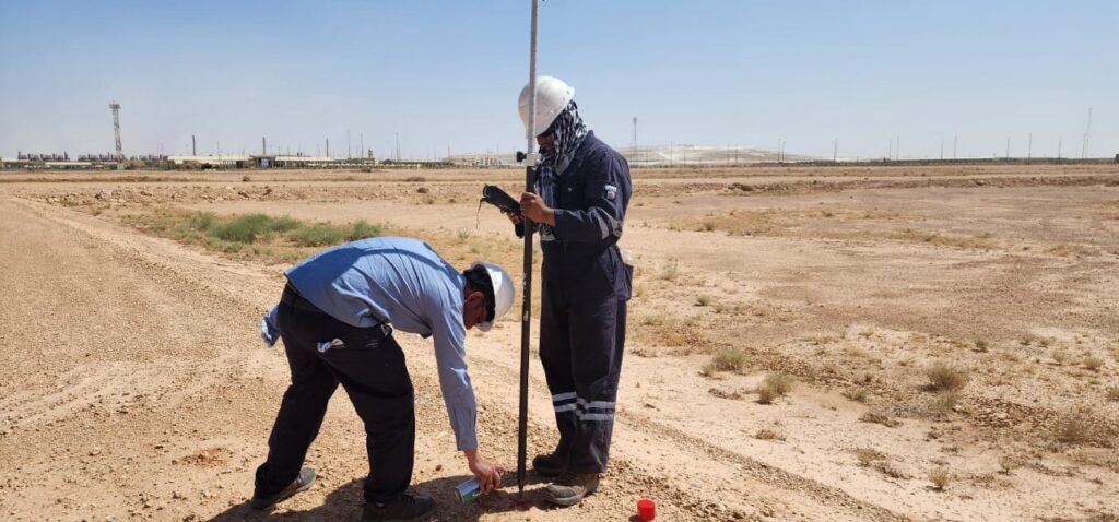
- Survey control: detected utilities are positioned with GNSS and robotic total stations tied to the project coordinate system.
- Verification (QL-A): where required, trial pits expose utilities to confirm position, depth and type.
- Processing and QA: our geophysicists and data analysts interpret the data, and every utility is attributed with its quality level before the drawings are checked and issued.
When Do You Need a PAS 128 Survey?
- Before excavation, piling, trenching or drilling on any site with existing services
- At the design stage of roads, bridges, utilities and building projects, to avoid costly clashes and redesigns
- When existing records are missing, unreliable or conflicting
Deliverables
- Utility survey drawings in AutoCAD or Civil 3D with clear layer management to your CAD standard
- A quality level, utility type and estimated depth for each mapped line, where determinable
- 3D utility models for BIM Level 1/2 workflows on request
- A survey report covering methods, limitations, areas not surveyed and recommendations
- Trial pit records with photographs, where QL-A verification is included
Accuracy and Limitations
No method finds every utility in every ground condition. GPR depends on soil type and moisture, and EML only detects conductive services or those carrying a signal. That is why PAS 128 combines techniques and records a quality level for each result. We state clearly what was detected and where verification is recommended.
Records and Reconnaissance
We review the available records and inspect every visible surface feature on site, correlating manholes, valve covers, chambers and marker posts.
Detection with GPR and EML
Precision locators and our latest GSSI 350 HS (350 MHz HyperStacking) GPR system detect metallic and non-metallic utilities.
Survey Control
Detected utilities are positioned with GNSS and robotic total stations tied to the project coordinate system.
Verification and QA
Where required, trial pits expose utilities to confirm position, depth and type, and every utility is attributed with its quality level before the drawings are issued.
PAS 128 Methodology
Vehicle-Mounted GPR
One Team, Fieldwork to CAD
5+ Years, 100+ Projects
Why Choose EarthScape?
Sectors We Serve
We support construction, energy, mining and environmental projects, from international airports to residential sites, for contractors, consultants and developers.
Frequently Asked Questions
What is the difference between QL-B and QL-A?
QL-B means a utility was detected and mapped with geophysical methods such as GPR and EML. QL-A means it was physically exposed, usually in a trial pit, so its position and depth were confirmed directly.
Is PAS 128 mandatory in Saudi Arabia?
PAS 128 is a British specification, not a Saudi regulation. Many consultants and contractors in the Kingdom specify it because it gives a clear, recognized way to describe the reliability of utility information. Always check your project specification.
Can GPR find plastic pipes?
Often, yes. GPR responds to changes in material properties, so it can detect non-metallic pipes and ducts that electromagnetic locators cannot. Results depend on ground conditions, depth and pipe size.
How deep can a utility survey detect services?
It depends on soil conditions, the utility’s size and material, and the method. Detection depth varies from site to site, and our report states where reliable detection was limited.
How long does a PAS 128 survey take?
Small sites can often be surveyed in a day; large corridors take longer, although vehicle-mounted GPR speeds up road coverage. We confirm the schedule after reviewing your scope.
Book a PAS 128 Utility Survey
Planning excavation or design work anywhere in Saudi Arabia? Call us on +966 55 679 8661 or +966 53 875 9468, email info@earthscapesurvey.com, or contact our team with your site location and scope for a quotation.