
Electrical Resistivity Tomography (ERT) Survey in Saudi Arabia
Mapping subsurface conductivity with unmatched detail: Delivering critical geo-electrical insights for engineering, water resource management, and environmental assessment across the Kingdom.
ERT Survey Services Across Saudi Arabia
Boreholes tell you what is under one spot. An ERT survey shows what is happening along the whole line between them. Earthscape runs electrical resistivity tomography (ERT) surveys across Saudi Arabia to map cavities, bedrock depth, clay zones and groundwater before design and construction. We are based in Riyadh and mobilise to sites throughout the Kingdom.
What Is Electrical Resistivity Tomography?
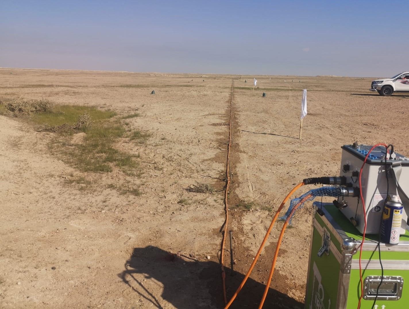
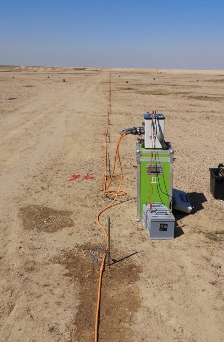
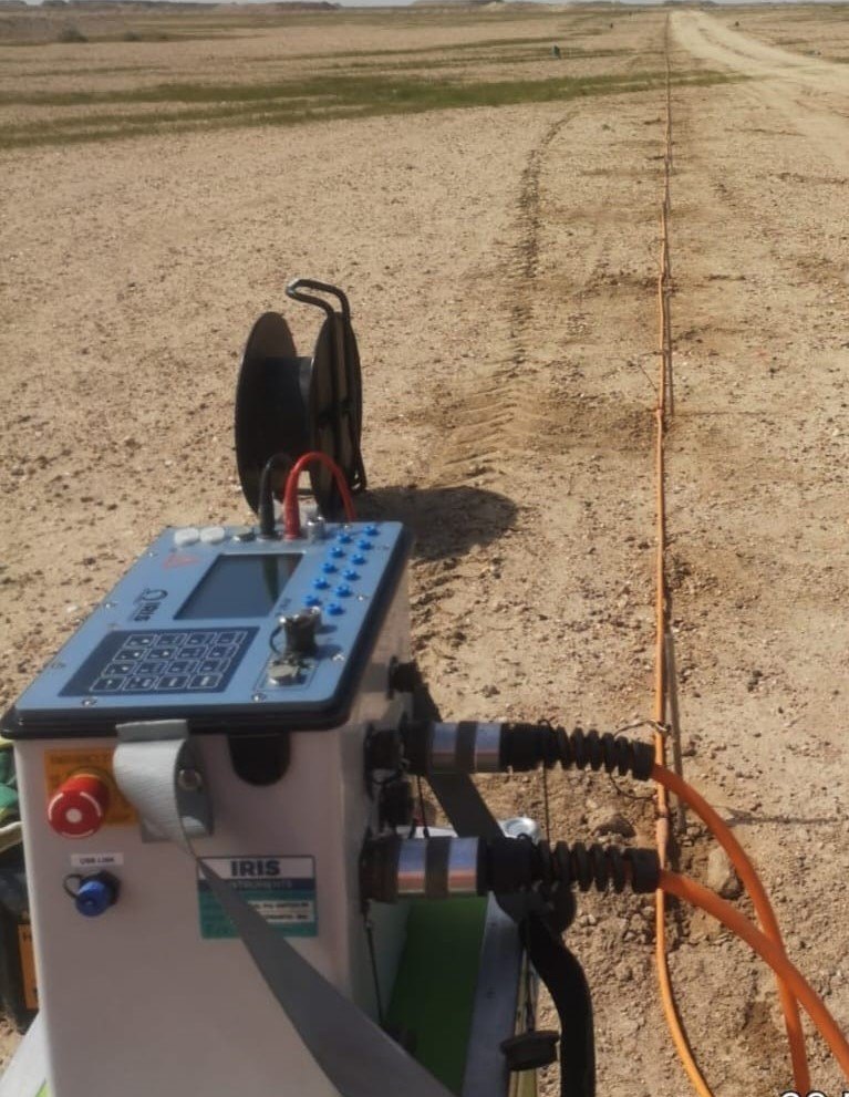
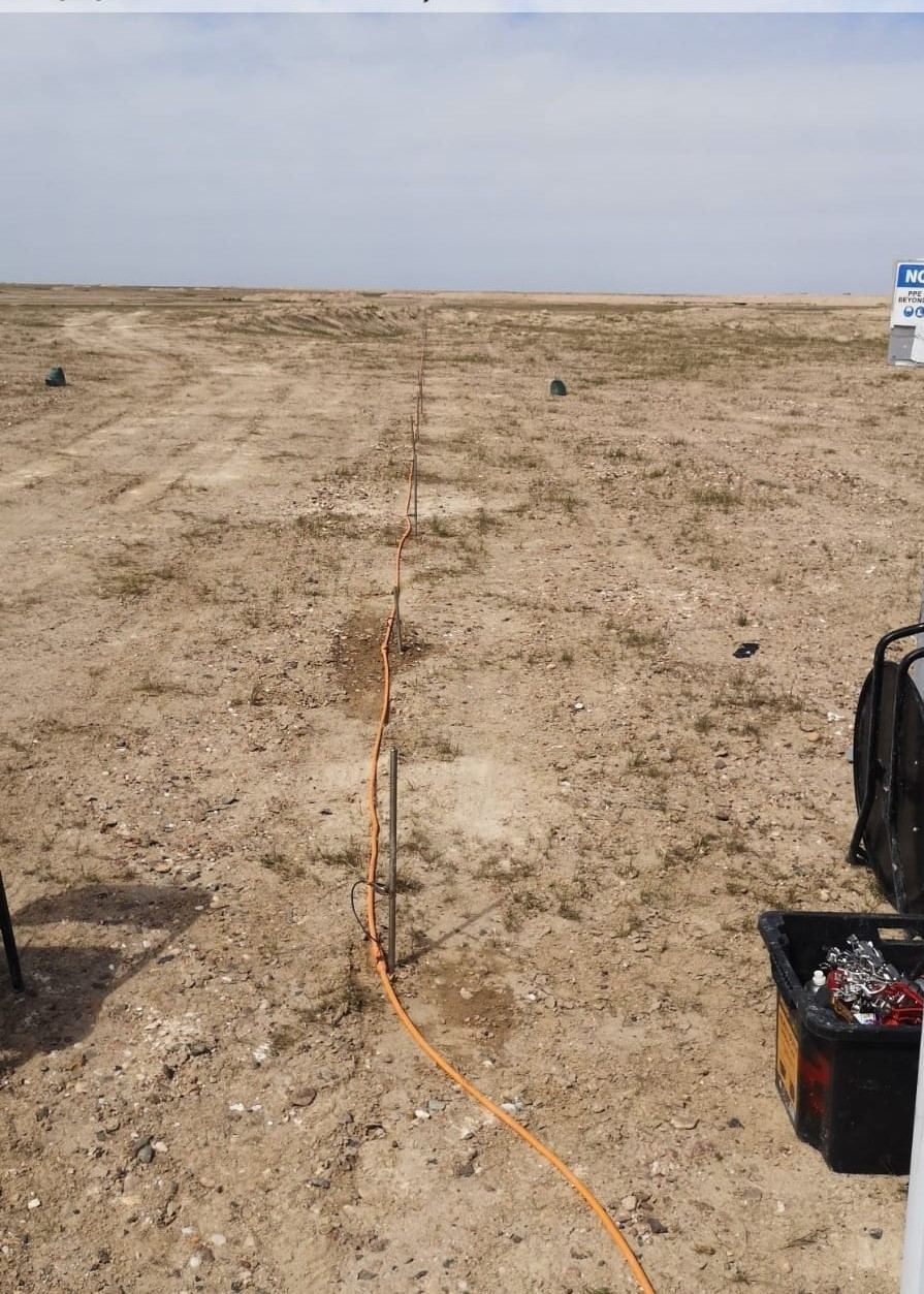
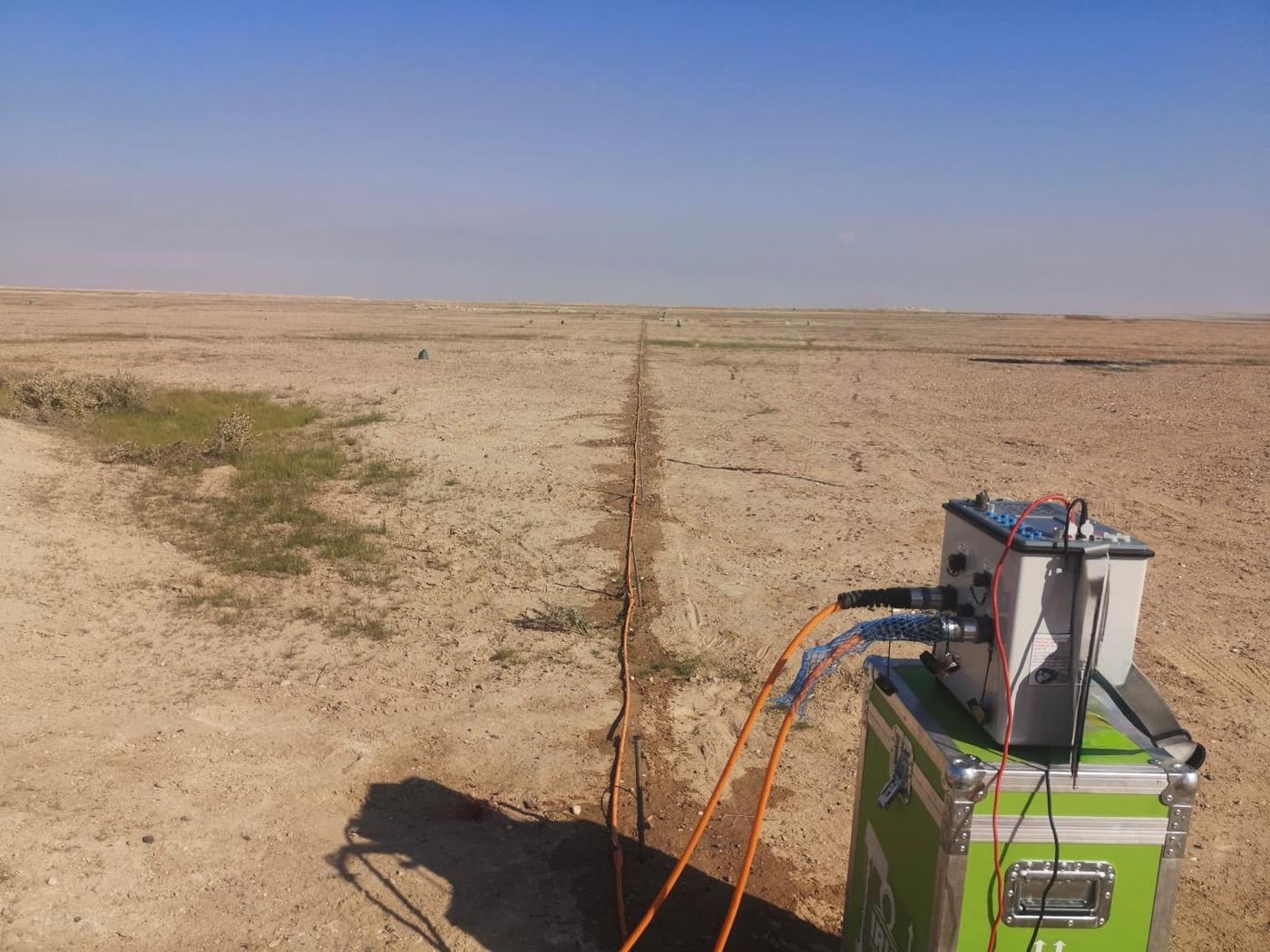
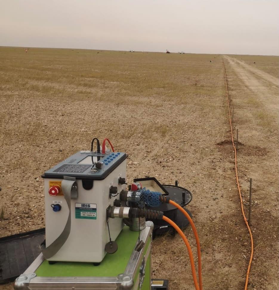
ERT measures how easily electric current passes through the ground. We lay out a line of steel electrodes, connect them to a resistivity meter, and the instrument passes a small current between pairs of electrodes while reading voltage at others. It repeats this for hundreds of combinations. The readings are then processed (inverted) into a cross-section that shows resistivity against depth and distance.
Different materials read differently. Dry sand, solid limestone and air-filled voids are usually high resistivity. Clay, wet ground and salty groundwater are usually low. That contrast is what lets us pick out layers and anomalies that matter to the engineer.
When an ERT Survey Makes Sense
- Cavity and karst screening: limestone areas in KSA can hide voids and weak zones. ERT is one of the main tools in our cavity and sinkhole detection work.
- Depth to bedrock: mapping the soil-rock boundary across a site or along a road, pipeline or canal route.
- Groundwater: locating water-bearing layers and showing where water quality changes, for example fresh water over saline water.
- Borehole planning: putting boreholes on the anomalies instead of on a blind grid, so fewer holes answer more questions.
- Environmental work: tracing wet or altered zones that may relate to leaks or contamination.
ERT for Groundwater in KSA
Water is a serious question for farms, camps, remote facilities and developers. A resistivity survey does not replace drilling, but it shows where drilling is most likely to be worth it. Long ERT lines can map the thickness of sediments over rock, identify possible water-bearing zones and highlight areas where salinity is likely to be high. The client then drills on informed targets rather than on guesswork.
2D and 3D ERT
2D ERT
Electrodes along a straight line give a vertical section. This is the standard setup for routes, foundations and general site screening. Longer lines and wider electrode spacing reach deeper; shorter spacing gives more detail near the surface.
3D ERT
Several parallel lines or a grid give a 3D model. We use this when a suspected cavity or weak zone has to be mapped in plan as well as depth, for example under a planned building footprint.
Our Field Method
- Planning: we agree the targets and depth needed, then choose line positions, electrode spacing and array type.
- Setting out: lines are positioned with GNSS so every section ties into project coordinates and levels.
- Acquisition: our crew installs electrodes, checks contact resistance (dry desert sand often needs watering with salt solution) and records data.
- Processing: data is cleaned and inverted, with topography included where the ground is not flat.
- Interpretation: we read the sections against borehole logs and site geology where available.
What You Receive
- Location plan of all ERT lines
- Colour resistivity sections with depth and chainage
- Interpreted sections marking layers, likely rock and anomalies
- Recommendations for boreholes or further checks
- Digital data and drawings for your design team
Combining ERT with Other Methods
No single method answers everything, so ERT often runs with others. MASW adds ground stiffness, seismic refraction confirms rock depth and the GPR survey gives fine detail in the top few metres. Everything is then checked with a geotechnical investigation. If you need resistivity for electrical earthing design, see our separate soil resistivity test service.
Why Earthscape
Earthscape has 5+ years of work in Saudi Arabia, 100+ projects and 40+ clients. Our 20+ experts each have 10+ years of experience, and the same people who collect the data are involved in interpreting it, which keeps the results tied to what was seen on the ground.
This service is part of our wider geophysical survey in Saudi Arabia services, which combine several methods when a project needs them.
Frequently Asked Questions
How deep can an ERT survey see?
Depth depends mainly on line length. As a rough guide, investigation depth is about a fifth of the total line length, so longer lines are used for deeper targets.
Can ERT find cavities for sure?
ERT shows anomalies that are consistent with voids, such as high-resistivity zones in limestone. These should be checked by drilling. Used together, the two are far more reliable than either one alone.
Does ERT work on dry desert sand?
Yes, but dry sand makes electrode contact harder. We water the electrodes and check contact before each reading, so the data stays usable.
How long does an ERT survey take?
A crew can usually record several lines in a day, depending on length and access. Processing and reporting follow after the field work.
Get a Quote
Send us the site location, a drawing or Google Maps pin, and what you need to know. We usually reply with questions first, then a clear scope and price. Email info@earthscapesurvey.com or use the Get a Quote page.
Reliable, Accurate Results
Precision ERT for Diverse Project Needs
Groundwater & Hydrogeology
ERT is the go-to method for mapping the distribution and quality of water resources, which is vital for sustainable development in arid regions.
Geotechnical & Engineering Site Surveys
Providing crucial information for civil engineering projects by characterizing soil and rock layers and detecting subsurface anomalies.
Cavity & Hazard Detection
Highly effective for identifying subsurface features that pose stability risks to infrastructure across the Kingdom’s karstic and vulnerable areas.
Environmental & Mining Applications
Used for non-invasive exploration and monitoring of natural resources and for mapping subsurface contamination.
Ideal for Saudi Arabia's Infrastructure
Our ERT solutions offer critical, site-specific data that is essential for mitigating risk and ensuring the longevity of projects aligned with Vision 2030.
Complex Subsurface Resolution
Provides high-definition imaging in areas with highly varied and complex geological layers.
Cost-Effective Alternative
Reduces the need for excessive drilling by intelligently guiding borehole placement.
2D & 3D Modeling
Deliver intuitive cross-sectional and volumetric models for clearer interpretation and planning.
Environmental Integrity
Ideal for non-destructive surveys in sensitive natural or archaeological sites.
Depth Flexibility
Electrode spacing and line length are chosen to reach the depth your project needs.
100+ Projects Completed
ERT Survey Projects in Saudi Arabia
Multi-electrode resistivity lines laid across desert ground to image cavities, groundwater, bedrock and soil layers.
See more field photos in our survey project portfolio.