Hydrographic Survey in Saudi Arabia
Mapping the Depths: Delivering foundational marine intelligence for safe navigation, coastal development, and energy infrastructure across the Red Sea and Arabian Gulf.
Hydrographic Survey Services Across Saudi Arabia
On land you can walk the site and see the ground. Underwater you cannot, so every metre of seabed has to be measured. Earthscape carries out hydrographic surveys in Saudi Arabia for ports, jetties, marinas, coastal developments, intakes, outfalls and subsea cable and pipeline routes. Our office is in Riyadh, and our teams work on both the Red Sea and Arabian Gulf coasts as well as inland lakes, reservoirs and lagoons.
What a Hydrographic Survey Tells You
A hydrographic survey measures water depth, the shape of the seabed and anything sitting on or just under it. Designers use it to set dredge levels, place structures, plan routes and check that vessels have safe clearance. Contractors use it to measure dredged volumes and confirm work is complete.
Bathymetric Survey
Bathymetry is the depth part of the job, and it is the core of almost every hydrographic project.
Single-Beam Echo Sounding
A single-beam echo sounder records depth directly below the boat along planned lines. It suits shallow water, simple profiles, channels and routine checks where full coverage is not needed.
Multibeam Echo Sounding
A multibeam system records a wide strip of depths with every pass, building a dense 3D surface of the seabed. It is the right choice where full coverage matters, such as berths, approach channels and areas where small obstructions must not be missed.
Seabed and Sub-Seabed Imaging
Side-Scan Sonar
Side-scan sonar produces an image of the seabed surface. It shows debris, rock outcrops, existing cables and changes in seabed type that a depth survey alone might not show clearly.
Sub-Bottom Profiling
A sub-bottom profiler looks into the layers below the seabed. It helps estimate sediment thickness over rock, which matters for dredging, piling and pipeline burial. Results are best confirmed with marine boreholes or samples.
Positioning, Tides and Datums
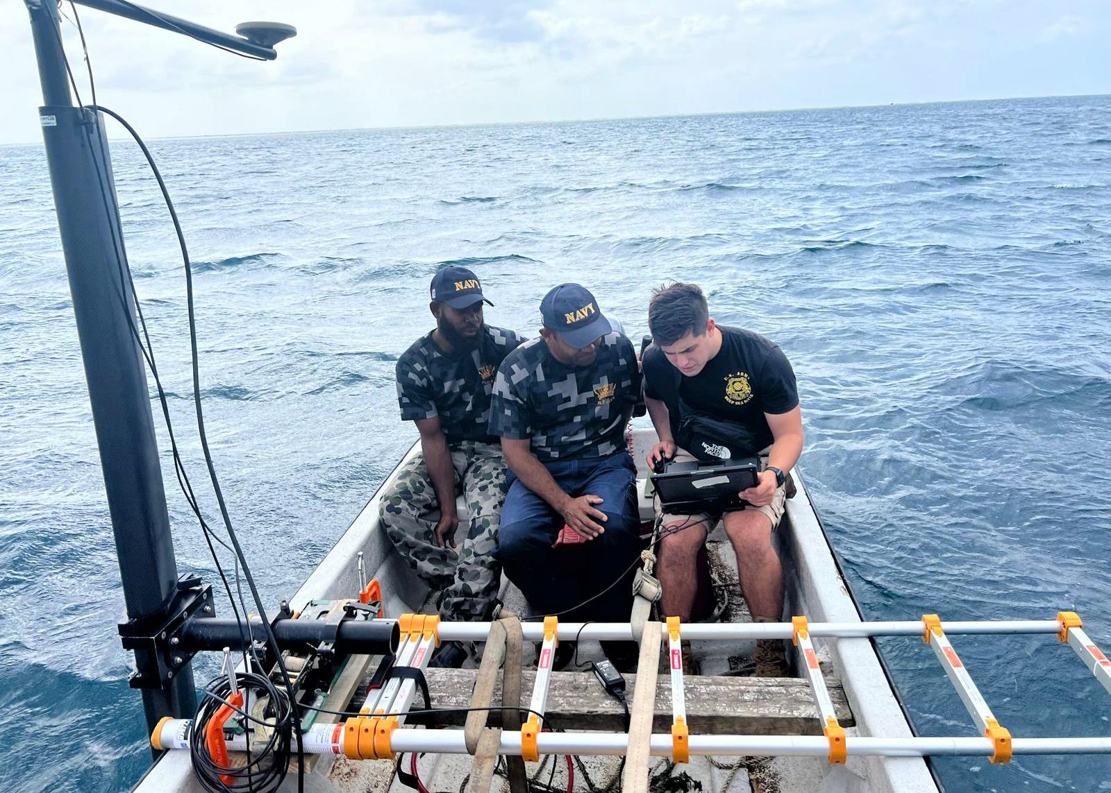
A depth is only useful if you know exactly where it was measured and what level it refers to. We position the vessel with GNSS, correct for heave, pitch and roll, and reduce soundings for tide or water level. Final depths are delivered on the agreed vertical datum and project coordinate system, so they line up with your land drawings.
When You Need a Hydrographic Survey
- Design of ports, jetties, breakwaters, marinas and waterfront projects
- Pre-dredge and post-dredge surveys with volume calculations
- Route surveys for subsea pipelines, cables, intakes and outfalls
- Checking navigation depths and locating obstructions
- Repeat surveys to monitor siltation, scour and shoreline change
- Reservoir and lagoon capacity surveys
Joining Marine and Land Data
Coastal projects fail at the waterline when marine and land surveys are done separately on different systems. We tie the hydrographic survey to a topographic survey of the shore, and where needed add drone survey mapping of the beach and intertidal zone. For seabed geology we can add seismic methods, and for structures near the shore our geotechnical investigation team can follow up. Final drawings can be prepared by our CAD drafting team.
How We Run the Job
- Planning: we agree survey limits, line spacing, coverage and accuracy with you.
- Calibration: echo sounder and motion checks are done before survey starts each day.
- Acquisition: the survey vessel runs planned lines, with cross lines for quality control.
- Processing: data is cleaned, tide-corrected and gridded.
- Delivery: charts, contours, sections and digital surfaces in the formats your team uses.
Deliverables
- Bathymetric charts with soundings and contours
- Digital terrain model of the seabed
- Cross sections and long sections along routes or channels
- Dredge volume calculations where required
- Seabed feature and obstruction plots from side-scan sonar
- Survey report with methods, datums and quality checks
About Earthscape
Earthscape has 5+ years working in Saudi Arabia, 100+ projects and 40+ clients. Our 20+ experts each bring 10+ years of survey experience on land and water.
Frequently Asked Questions
What is the difference between hydrographic and bathymetric survey?
Bathymetry is measuring water depth. A hydrographic survey is broader and can also include seabed imaging, sub-bottom layers, tides and shoreline features.
Do I need multibeam or is single-beam enough?
Single-beam is fine for simple profiles and shallow areas. Multibeam is better where you need full coverage or must find small obstructions. We will recommend the right one for your purpose.
Can you survey very shallow water?
Yes. Shallow areas can be covered with small boats, and the shore and intertidal zone can be picked up by land survey or drone so there is no gap.
Which coasts do you cover?
We work on the Red Sea and Arabian Gulf coasts of Saudi Arabia, and on inland water bodies.
Get a Quote
Send us the site location, a drawing or Google Maps pin, and what you need to know. We usually reply with questions first, then a clear scope and price. Email info@earthscapesurvey.com or use the Get a Quote page.
Reliable, Accurate Results
Precision Hydrographic Surveying for Diverse Project Needs
Maritime Safety & Navigation
Accurate depth data for safe navigation channels, berths and approaches.
Coastal & Port Infrastructure
Supporting the planning, construction, and maintenance of vital port facilities and coastal real estate developments.
Offshore Energy & Subsea Cables
Essential for the development and maintenance of the Kingdom’s world-leading offshore oil and gas facilities and telecommunication networks.
Environmental & Scientific Studies
Collecting data vital for protecting sensitive marine ecosystems and managing natural resources.
Ideal for Saudi Arabia's Infrastructure
Our Hydrographic Survey services are specifically tailored to the unique geological and regulatory challenges of Saudi Arabian waters, supporting the nation's ambitious maritime and economic goals.
Red Sea & Arabian Gulf Expertise
Proven capability in navigating the complexities of both marine environments, including deep-water and shallow coastal areas.
Echo Sounder Surveys
Single-beam or multibeam echo sounding selected for the area and the detail required.
Integrated Geophysical Data
Surveys are often combined with sub-bottom profiling to image the shallow geology beneath the seabed.
Coastal Development Support
Critical for the new wave of gigaprojects where marine and land surveying must be precisely tied together.
100+ Projects Completed