Underground Utility Detection in Saudi Arabia
Find and map buried cables, pipes and ducts with GPR, cable locating and trial pits before you design, dig or drill.
Utility Detection and Mapping Services Across Saudi Arabia
Striking a buried cable or pipe can injure workers, shut down operations and delay a project for weeks. EarthScape Surveys provides underground utility detection and utility mapping across Saudi Arabia, so contractors, consultants and owners know what is below the ground before they design, dig, pile or drill. We work from our head office in Riyadh and operations office in Al Khobar, on city streets, industrial plants, oil and gas facilities and greenfield sites.
What Is Underground Utility Detection?
Underground utility detection finds buried services such as power and telecom cables, water and sewer lines, gas pipes, fibre ducts and drainage, and records their position and approximate depth. Because utility records in many areas are incomplete or out of date, a site survey is the only reliable way to know what is actually there. The results are used to mark services before excavation and to map them for design.
Our Utility Detection Methods
- GPR survey – radar imaging that finds metallic and non-metallic pipes, cables, ducts and voids.
- Cable and pipe locating – electromagnetic (radio-detection) tracing of live power cables and metallic pipes over long distances.
- Trial pits – careful excavation to expose and confirm service type, size and depth where certainty is critical.
- PAS 128 utility survey – surveys planned and reported to PAS 128 survey types and quality levels.
- Records research – collecting and reviewing available utility records and as-built drawings before fieldwork.
Using several methods together finds far more than any single method, because each one detects different services and has different limits.
When You Need Underground Utility Detection
- Before excavation, trenching, piling, horizontal directional drilling or foundation works.
- During design of roads, plants, substations, pipelines and buildings, to avoid clashes.
- Before tie-ins and new installations on brownfield and operating industrial sites.
- To meet client excavation procedures and permit-to-work requirements.
- To update incomplete utility records and as-built drawings.
How We Deliver a Utility Survey
- Scope and records. We agree the area, the services to be found and the quality level needed, and review available records.
- Site walkover. We record visible features such as manholes, valve chambers, markers and poles, and set up safety controls.
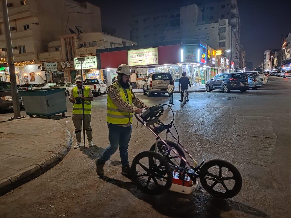
- Detection. We scan a planned grid with GPR and trace services with electromagnetic locators.
- Marking and positioning. Services are marked on the ground and positioned with RTK-GNSS or a total station.
- Verification. Trial pits are recommended and carried out where the risk requires confirmation.
- Mapping and reporting. We deliver CAD and GIS utility drawings and a report stating methods, depths achieved and limitations.
Utility Mapping Deliverables
- Utility drawings in AutoCAD (and GIS on request) in project coordinates.
- Service type, approximate depth and quality level for each line.
- Ground marking with paint or pegs for excavation crews.
- Trial pit records with photos and measurements, where carried out.
- A survey report covering methodology, equipment, limitations and recommendations.
Utility Detection Across Saudi Arabia
Ground conditions change how detection works. Dry inland soils around Riyadh allow deep radar penetration, while wet, saline ground near the Gulf coast in Dammam, Al Khobar and Jubail limits radar depth and makes electromagnetic locating and trial pits more important. Read our guide to GPR in Riyadh, Dammam and Al Khobar for more.
Why Choose EarthScape for Utility Detection?
- Our own GSSI 350 MHz HyperStacking GPR, Radiodetection locators and Trimble RTK-GNSS.
- Experienced operators and geophysicists who interpret results, not just collect data.
- Honest reporting of what was and was not detected, with quality levels for each service.
- Safe work under client permit-to-work systems, with ISO 9001, ISO 14001 and ISO 45001 certification.
- Registered Saudi Aramco supplier (Vendor Code 10118447).
Learn more in why locate underground utilities before excavation and PAS 128 quality levels explained.
Frequently Asked Questions
What is underground utility detection?
Underground utility detection is the process of finding and mapping buried services such as power and telecom cables, water, sewer and gas pipes, and fibre ducts before excavation or design. It combines ground penetrating radar (GPR), electromagnetic cable and pipe locating, records research and, where needed, trial pits.
Which methods do you use to detect underground utilities?
EarthScape uses GPR to find metallic and non-metallic services, Radiodetection electromagnetic locators to trace live cables and metallic pipes, and trial pits to expose and confirm critical services. Every detected service is positioned with RTK-GNSS or a total station.
What is the difference between utility detection and utility mapping?
Detection finds and marks services on the ground so work can proceed safely. Mapping records them in project coordinates on a CAD or GIS drawing with type, approximate depth and quality level, so designers can use them. EarthScape delivers both.
Can you detect plastic pipes?
Yes. GPR detects plastic, concrete and clay pipes as well as metallic ones, which cable locators alone cannot. Very small plastic pipes in wet or saline ground are harder to see, so critical services are confirmed with trial pits.
Do you follow PAS 128?
Yes. We plan and report surveys using PAS 128 survey types and quality levels (QL-D to QL-A) when the client requires it, and we work to client excavation procedures, including Saudi Aramco requirements, as a registered supplier (Vendor Code 10118447).
How quickly can you mobilise?
With offices in Riyadh and Al Khobar, we mobilise as soon as the scope, permits and site access are confirmed. Timing for remote sites depends mainly on access and permit approvals.
Request a Utility Detection Quote
Send us the site location, survey area and planned works through our Get a Quote page, and we will propose the right methods, quality level and programme.
Reliable, Accurate Results
Utility Detection for Every Type of Project
Roads & Infrastructure
Locate cables, pipes and ducts under roads and junctions before widening, drainage and new utility works.
Industrial & Oil and Gas Plants
Map congested pipe corridors, cables and earthing before tie-ins, foundations and excavations under permit.
Buildings & Developments
Clear plots and corridors before piling, foundations and service connections.
Substations & Power
Trace live HV and LV cables and earthing before trenching and cable laying.
Ideal for Saudi Arabia's Infrastructure
Our utility surveys give you accurate, positioned information on buried services, reducing strike risk, redesign and delays.
Multi-Method Detection
GPR and electromagnetic locating together find more services than either method alone.
PAS 128 Quality Levels
Each service is reported with a quality level so designers know how reliable it is.
Accurate Positioning
Every service is tied to project coordinates with RTK-GNSS or a total station.
Verified by Trial Pits
Critical services are exposed and confirmed before excavation.
Safe, Certified Delivery
ISO 9001, ISO 14001 and ISO 45001 certified, working under client permits as a Saudi Aramco supplier.
100+ Projects Completed