Geophysical Survey in Saudi Arabia
GPR, ERT, MASW, seismic, magnetic and microgravity surveys to see below the ground before you design, dig or build.
Geophysical Survey Services Across Saudi Arabia
EarthScape Technologies is a Saudi geophysical survey company providing engineering and environmental geophysics across the Kingdom. From our head office in Riyadh and operations office in Al Khobar, our geophysicists and surveyors investigate what lies below the ground for contractors, consultants and owners, so that foundations, utilities, roads and plants are designed and built on reliable information.
What Are Geophysical Surveys?
A geophysical survey measures a physical property of the ground from the surface: how it conducts electricity, how fast seismic waves travel through it, how it reflects radar, or how it changes the Earth’s magnetic and gravity fields. Changes in those properties show changes below ground, such as a different soil layer, the top of rock, a cavity, groundwater or a buried pipe. Because the measurements are non-destructive and cover large areas quickly, a geophysical survey in Saudi Arabia is usually the fastest way to understand a site before drilling, excavation or design.
Types of Geophysical Surveys We Offer
- GPR survey in Saudi Arabia – high-resolution radar imaging of utilities, voids, rebar and shallow layers in the top few metres.
- ERT survey in Saudi Arabia – 2D and 3D resistivity imaging of cavities, clay zones, groundwater and bedrock to tens of metres.
- MASW survey in Saudi Arabia – shear-wave velocity profiles and Vs30 for seismic site class and foundation design.
- Seismic survey in Saudi Arabia – seismic refraction for rock depth and rippability, and borehole seismic (downhole and crosshole) testing.
- Magnetic survey in Saudi Arabia – detection of buried metal, tanks, pipelines and archaeological features.
- Gravity and microgravity survey – detection of voids and density changes where other methods are limited.
- Cavity and sinkhole detection – combined methods for karst and void risk on sites and roads.
- Soil resistivity and earthing test – Wenner measurements for earthing and cathodic protection design.
Why Geophysical Surveys Matter in Saudi Arabia
- Karst and cavities in limestone areas of the Eastern Province, Riyadh and other regions can be missed by widely spaced boreholes.
- Large sites and long corridors for giga-projects, industrial zones, roads and pipelines need continuous ground information, not just a few test points.
- Rock excavation costs depend on whether rock can be ripped or must be blasted.
- Seismic design under the Saudi Building Code needs a site class, often based on Vs30.
- Crowded utilities in cities and plants must be located before excavation.
- Earthing and corrosion protection for substations, plants and pipelines need soil resistivity data.
How Do Geophysical Surveys Work?
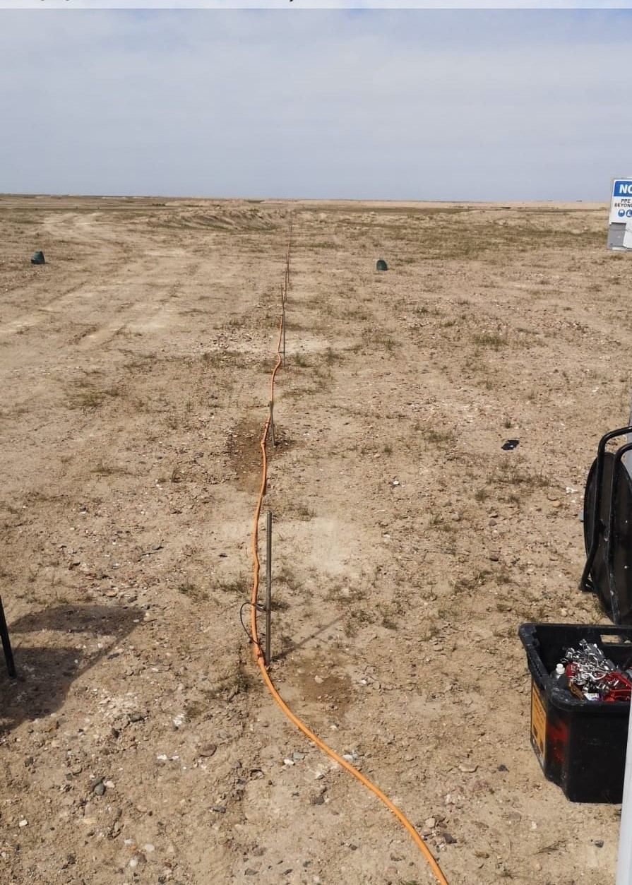
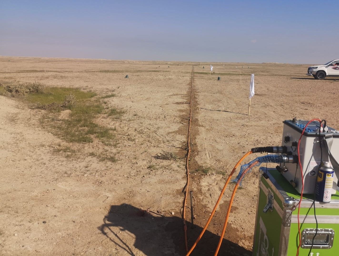
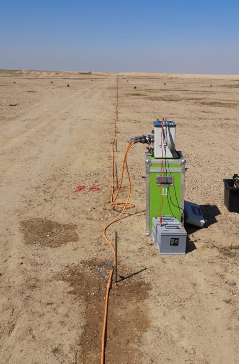
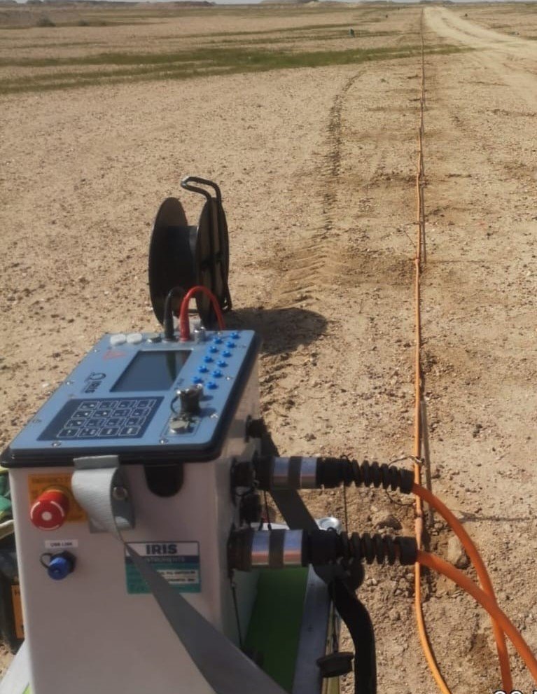
Every geophysical survey follows the same principle: a sensor on the surface measures a physical signal that is affected by what lies below. Some methods are active and send energy into the ground, such as radar pulses (GPR), electric current (ERT) or seismic waves (MASW and seismic refraction), then record how it comes back. Others are passive and measure natural fields, such as the Earth’s magnetic field or gravity. Readings are taken along lines or on a grid, positioned with GNSS, and processed into sections, maps and 3D models that show where the ground changes.
What Type of Data Do Geophysical Surveys Collect?
- Electrical resistivity – how strongly the ground resists electric current (ERT, soil resistivity tests).
- Seismic velocity – how fast compression and shear waves travel (seismic refraction, MASW, borehole seismic).
- Radar reflections – echoes from pipes, voids, rebar and layer boundaries (GPR).
- Magnetic field – small changes caused by buried iron and steel or magnetic rocks (magnetic surveys).
- Gravity – tiny differences in mass caused by voids or dense rock (microgravity surveys).
Each data type is then interpreted together with boreholes, trial pits and site information to describe soils, rock, groundwater, cavities and buried objects.
Geophysical and Geotechnical Surveys: How They Work Together
A geotechnical survey drills boreholes and tests samples to measure soil and rock properties at specific points. A geophysical survey covers the whole area between those points from the surface. Used together, geophysics shows where ground conditions change and where to drill, and boreholes confirm and calibrate what the geophysics shows. EarthScape often plans both as one investigation with our geotechnical investigation service.
Applications
Our geophysical surveys support geotechnical investigation and foundation design, cavity and sinkhole risk assessment, groundwater and environmental studies, excavation and earthworks planning, earthing system design, utility detection before digging, and pre-construction checks for roads, substations, plants and buildings. We often combine geophysics with geotechnical investigation and topographic surveys, so the client receives surface and subsurface information together.
How We Deliver a Geophysical Survey
- Define the question. We review drawings, borehole logs and site conditions and agree what the survey must answer.
- Design the survey. We select the method or combination of methods, line positions, lengths and spacings for the target depth and resolution.
- Fieldwork. Our team works with our own equipment under the client’s permit-to-work system, with a site-specific risk assessment and daily toolbox talks.
- Positioning. Every line and result is tied to project coordinates with RTK-GNSS or total station.
- Processing and interpretation. Data is processed in-house and interpreted by experienced geophysicists, calibrated against boreholes and trial pits where available.
- Reporting. Clear sections, maps and CAD/GIS drawings, with plain-language conclusions and recommendations for follow-up investigation.
Deliverables
- Interpreted 2D sections and 3D models, depth slices and contour maps.
- Vs30 and site class results for seismic design (MASW).
- Utility and anomaly drawings in AutoCAD and GIS formats.
- A technical report covering methodology, equipment, data quality, interpretation, limitations and recommendations.
Why Choose EarthScape for Geophysical Surveys?
- A Saudi company with offices in Riyadh and Al Khobar, working across the Kingdom.
- Experienced geophysicists who design, run and interpret the survey, not just collect data.
- A wide range of methods in-house, so we recommend what fits your site rather than the one tool we own.
- ISO 9001, ISO 14001 and ISO 45001 certified management systems.
- Registered Saudi Aramco supplier (Vendor Code 10118447).
Read our guides to ERT, MASW and Vs30, microgravity and magnetic surveys to learn more about each method.
Frequently Asked Questions
What type of data do geophysical surveys collect?
Geophysical surveys collect measurements such as electrical resistivity, seismic wave velocity, radar reflections, magnetic field strength and gravity. These are processed into sections, maps and models that show soil and rock layers, groundwater, cavities and buried objects.
What is the difference between geophysical and geotechnical surveys?
Geotechnical surveys drill boreholes and test samples at specific points, while geophysical surveys image the ground continuously from the surface. Geophysics guides where to drill, and boreholes calibrate the geophysics, so the two are best used together.
Are geophysical surveys used in archaeology?
Yes. GPR, magnetic and resistivity surveys are widely used to map buried walls, rooms and features without excavation, which is useful for heritage and tourism projects in Saudi Arabia.
What is a geophysical survey?
A geophysical survey measures physical properties of the ground, such as electrical resistivity, seismic velocity, radar reflection, magnetism or gravity, from the surface. Changes in these properties reveal buried utilities, voids, soil and rock layers, groundwater and other features without digging.
Which geophysical survey methods does EarthScape offer?
EarthScape offers ground penetrating radar (GPR), electrical resistivity tomography (ERT), MASW, seismic refraction and borehole seismic, magnetic surveys, gravity and microgravity surveys, cavity and sinkhole detection, and soil resistivity testing, across Saudi Arabia.
How do I choose the right geophysical method?
Start from the question you need answered. GPR suits shallow utilities and voids, ERT suits cavities, groundwater and earthing design, MASW suits stiffness and Vs30, seismic refraction suits rock depth and rippability, and magnetic and microgravity suit buried metal and deeper voids. We recommend the method, or combination, after reviewing your site.
Can geophysics replace boreholes?
No. Geophysics fills the gaps between boreholes and shows where ground conditions change, so fewer boreholes are needed and they can be placed where they matter most. The best results come from using both.
How deep can a geophysical survey investigate?
It depends on the method and the ground. GPR typically sees the top few metres, ERT and seismic refraction commonly reach tens of metres, and MASW is usually designed to 30 m or more for Vs30. We design line lengths and spacings to the depth your project needs.
Do you work on Saudi Aramco and industrial sites?
Yes. EarthScape is a registered Saudi Aramco supplier (Vendor Code 10118447) and works under client permit-to-work systems, supported by ISO 9001, ISO 14001 and ISO 45001 certified management systems.
Request a Geophysical Survey Quote
Send us the site location, the project question and any drawings or borehole logs through our Get a Quote page, and our geophysicists will recommend the right method and programme.
Reliable, Accurate Results
Geophysical Surveys for Every Project Stage
Geotechnical & Foundation Design
MASW, seismic refraction and ERT map soil and rock layers, stiffness and the depth to rock between boreholes, giving designers continuous ground information.
Cavity & Karst Risk
ERT, microgravity and GPR locate voids and weak zones in limestone and poorly compacted ground before they affect roads, slabs and foundations.
Groundwater & Environmental Studies
Resistivity and electromagnetic methods map groundwater, saline zones, buried waste and disturbed ground for environmental and water projects.
Utilities & Pre-Excavation Checks
GPR, magnetic surveys and cable locating find buried pipes, cables, tanks and obstructions before excavation, piling or drilling.
Ideal for Saudi Arabia's Infrastructure
Our geophysical surveys give site-specific ground information that reduces risk, cost and delays on projects across the Kingdom.
Multi-Method Approach
We combine methods where needed, because each one sees the ground differently and together they give a more reliable answer.
Fewer, Better-Placed Boreholes
Geophysics shows where ground conditions change, so drilling is targeted where it matters most.
Calibrated, Positioned Results
Every result is calibrated against boreholes or trial pits where available and tied to project coordinates with RTK-GNSS.
Clear Engineering Deliverables
Sections, maps, Vs30 results and CAD/GIS drawings with plain-language conclusions engineers can use directly.
Safe, Certified Delivery
ISO 9001, ISO 14001 and ISO 45001 certified, working under client permit systems as a registered Saudi Aramco supplier.
100+ Projects Completed