“Can we rip it, or do we need to blast?” is one of the most expensive questions on any earthworks job. The answer changes the equipment, the programme, the permits and the price. Boreholes help, but they only tell you about a few points. A seismic refraction survey shows how hard the ground is along whole lines across the site, which is why contractors and consultants in Saudi Arabia ask us for it before they price excavation in rock.
What seismic refraction measures
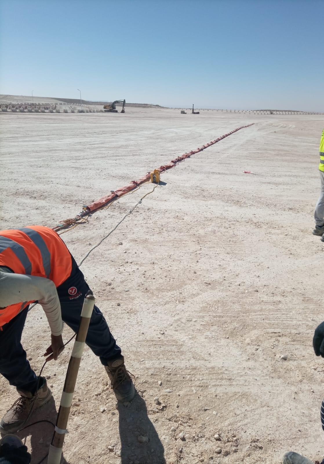
We lay out a straight line of geophones on the ground and create a small seismic wave at several points along it, usually with a sledgehammer on a steel plate or a heavier weight-drop source. The wave travels down, bends (refracts) along faster layers and returns to the surface. By timing the first arrival at each geophone, we can work out the compressional wave velocity (P-wave velocity) of each layer and how deep each boundary is.
Velocity is closely linked to how hard and how fractured a material is. Loose sand and fill are slow. Weathered and fractured rock sits in the middle. Fresh, massive limestone or granite is fast. That is why velocity is used as a guide to rippability.
From velocity to rippability
Equipment manufacturers publish rippability charts that relate seismic velocity to what a dozer of a given size can rip in different rock types. As a very rough guide, low velocities usually mean the material can be ripped easily, intermediate velocities are marginal and depend on the machine and the rock fabric, and high velocities often point to heavy ripping, hydraulic breakers or blasting.
The exact limits depend on the rock type, how the joints and bedding are oriented, and the size of the dozer. That is why we report velocities and a clear interpretation, and leave the final rippability call to the geotechnical engineer and the earthworks contractor, who combine it with borehole data and their own equipment.
How we run the survey
- Plan the lines. We look at the excavation footprint, cut depths and any boreholes, then place lines across the areas that matter. Line length controls depth: as a rule, the investigation depth is a fraction of the spread length, so deeper cuts need longer lines.
- Record the data. Several shots are recorded along each spread, including off-end shots, so both the shallow and deeper layers are covered. Multiple hits are stacked at each shot point to beat background noise from traffic and plant.
- Check on site. First arrivals are reviewed in the field before we pack up. If a record is noisy, it is repeated there and then.
- Survey the positions. Line positions and levels are measured with GNSS so the sections tie into your site drawings.
- Process and interpret. Arrival times are inverted into velocity sections, and layer boundaries are compared with borehole logs where they exist.
Limits you should know about
Standard refraction assumes velocity increases with depth. A slow layer under a faster one, such as soft material beneath a hard caliche crust, may not show up, and very thin layers can be missed. Boulders, cavities and abrupt changes along the line can also complicate the picture. For these reasons, refraction works best when it is calibrated with at least a few boreholes or trial pits. Where stiffness rather than hardness is the question, an MASW survey is often run on the same lines, because it measures shear-wave velocity and handles velocity inversions better.
Where it is used in the Kingdom
- Road and rail cuttings through limestone and weathered rock
- Basement and foundation excavations in rocky ground
- Pipeline and utility trenches across mixed ground
- Quarry planning and borrow-area assessment
- Planning where to drill boreholes on large sites
Frequently asked questions
How deep can seismic refraction see?
Depth depends mainly on the length of the geophone spread and the energy of the source. Longer lines and stronger sources reach deeper. We design the layout around the deepest cut you need to assess.
Does a seismic survey replace boreholes?
No. It fills the gaps between boreholes and shows where conditions change, so fewer boreholes are needed and they can be placed where they matter most.
Can you survey on a live construction site?
Yes, but noise from machinery and traffic affects the data. We plan shooting around site activities and stack more shots where needed.
Planning excavation in rock?
EarthScape carries out seismic refraction and borehole seismic surveys across Saudi Arabia, often alongside a geotechnical investigation. Send us the site layout, cut depths and any borehole logs through our Get a Quote page, and we will suggest line positions and a programme.